
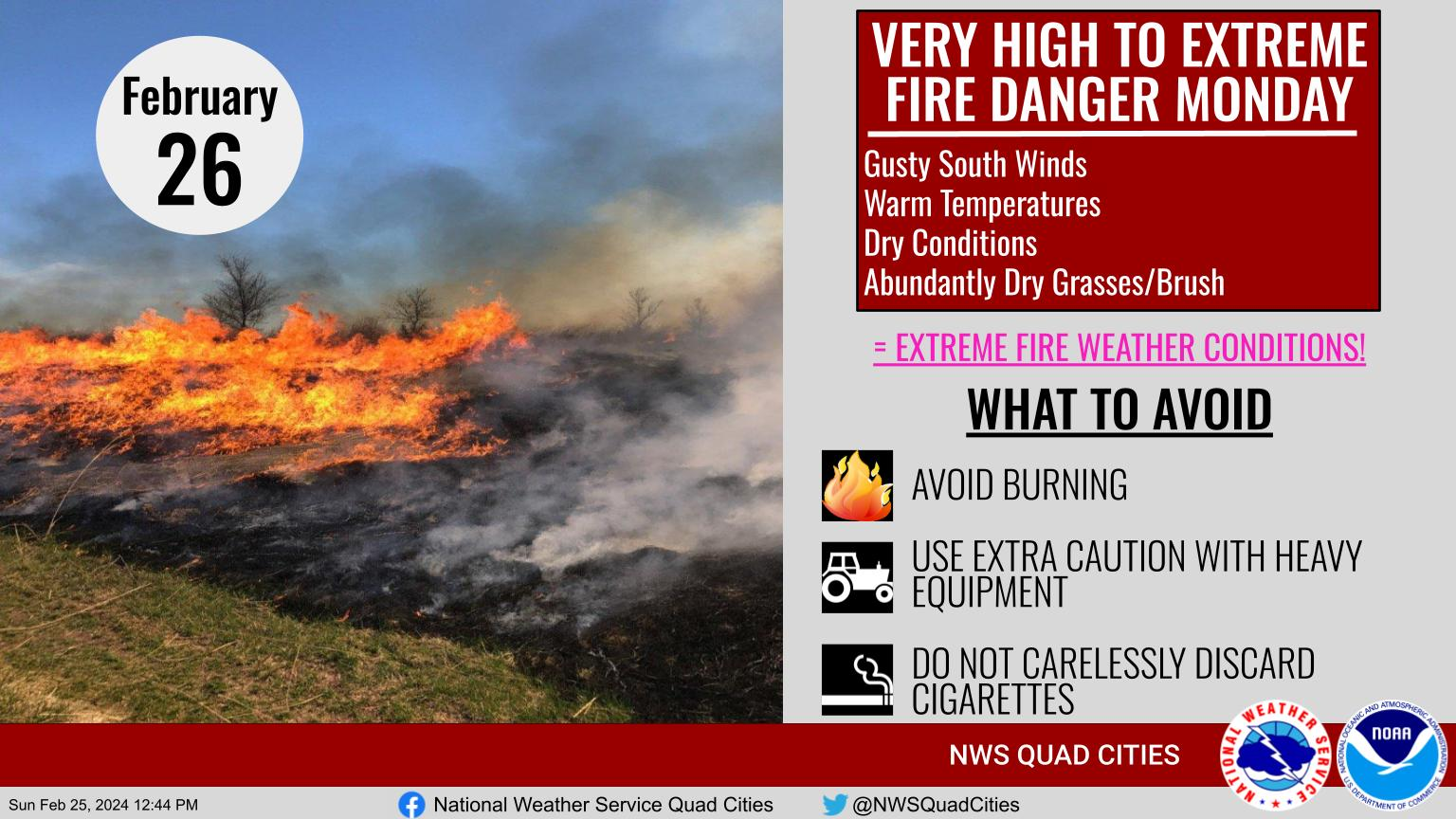
26 Feb Red Flag Warning for Very High to Extreme Fire Conditions
The National Weather Service has issued a Red Flag Warning for our area:

...Very High to Extreme Fire Danger Monday...

Buchanan-Delaware-Dubuque-Benton-Linn-Jones-Jackson-Iowa-Johnson-
Cedar-Clinton-Muscatine-Scott-Keokuk-Washington-Louisa-Jefferson-
Henry IA-Des Moines-Van Buren-Lee-Rock Island-Mercer-Henderson-
Warren-Hancock-McDonough-Scotland-Clark-
912 PM CST Sun Feb 25 2024

...RED FLAG WARNING REMAINS IN EFFECT FROM 9 AM TO 6 PM CST
MONDAY FOR VERY HIGH TO EXTREME FIRE CONDITIONS FOR EASTERN
IOWA...FAR NORTHEAST MISSOURI...AND WEST CENTRAL ILLINOIS...

* TIMING...9 AM TO 6 PM on Monday.

* WINDS...South 20 to 25 mph with gusts up to 35 to 40 mph.

* RELATIVE HUMIDITY...As low as 20 percent.

* TEMPERATURES...In the 70s.

* IMPACTS...Any fires will spread rapidly and be very difficult
  to control in these dangerous conditions. Outdoor burning
  should be avoided.

PRECAUTIONARY/PREPAREDNESS ACTIONS...

A Red Flag Warning means that critical fire weather conditions
are either occurring now, or will shortly. A combination of
strong winds, low relative humidity, and warm temperatures can
contribute to extreme fire behavior.

DO NOT BURN!